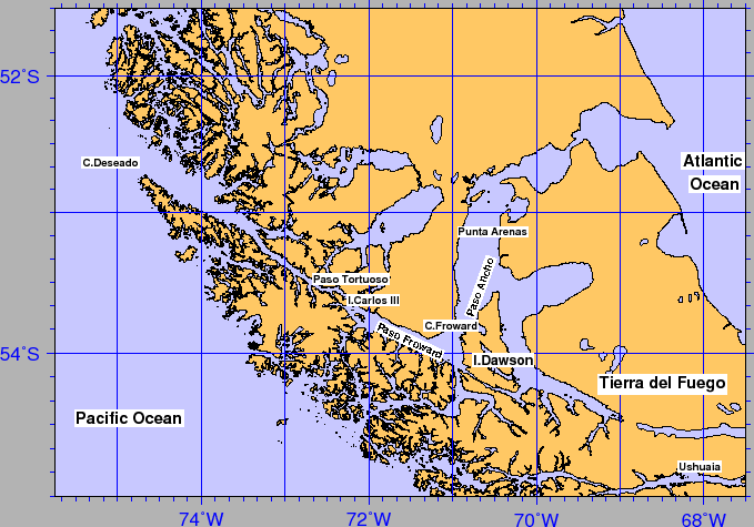
The Straits of Magellan (see Fig.3) is a semiclosed system influenced by South Pacific and Atlantic waters, with different sills and shelfs that separate deeper basins. It extends over about 570 km, and it is characterized by a significant spatial variability in the hydrographic features ([Artegiani et al.(1991)],[Panella et al.(1991)]), in the climatic and weather conditions, as well as in the geographical, morphological and geological setting [Brambati (1991)] and [Marinoni et al.(1997)], contributing to the development of widely differing oceanographic characteristics.
The central part of the Strait is occupied by Paso Ancho Basin, elongated N-S to Cape Froward with water depth 400 m south of Punta Arenas. The western sector, extends in a NW-SE direction from Cape Froward to the Pacific Ocean with narrow and elongated shape. Channel width varies from 2 km (Carlos III Island, Paso Tortuoso) to 15 km, with water depths reaching 1000 m NW of Paso Tortuoso and rising to 50 m near the Pacific entrance at Cape Deseado.
Tides and surface currents are particularly strong in the Atlantic entrance (with spring tide ranges of 9 m and currents reaching 4.5 m/s, respectively) with decreasing values towards the Pacific sector (about 1.5 m of spring tide range), as described in [Medeiros and Kjerfve (1988)]. The Island Carlos III (Paso Tortuoso) is a sill that separates two different oceanographical systems. In particular, the western section surface waters are more interested by run-off inputs.
figure