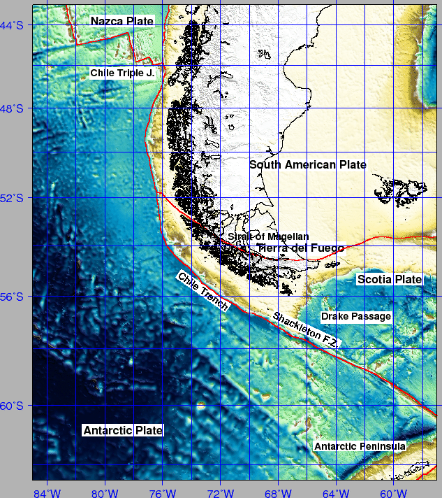
Cruise SCPM04 on R/V Explora was performed in the framework of the PNRA, and attempted to investigate the Chile Trench facing the mouth of the Strait of Magellan, after two cruises of R/V Explora (ITA-95 and ITA-97) that obtained high quality MCS data from Drake's Passage to North of Magellan (see Figure 1 and 2, and [Polonia et al.(1997)], [Polonia et al.(1998)]).
The request to PNRA for a new cruise in the area addressed and aimed to clarify the mechanisms of subduction accretion of the Antarctic plate sediments along the Southernmost Chilean margin. To reach the objectives it was proposed the acquisition of morpho-batymetric and seismic reflection data, as well as on the analysis of the multichannel seismic data acquired during two above cited cruises in the study area. After scientific approval, a cruise was scheduled with R/V Explora during Austral Summer Expedition 2003-2004.
Herein after the shipboard operations and results from cruise SCPM04 are presented.
figure
 |