


Next: ON-GOING DATA PROCESSING AND
Up: RESULTS AND DISCUSSION
Previous: SBP - SSS
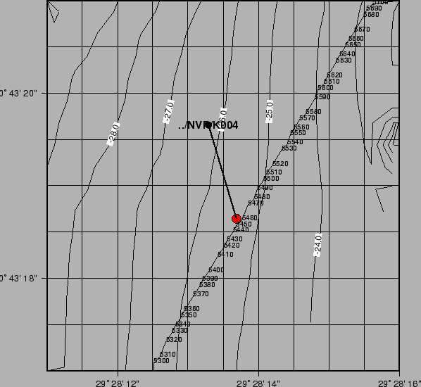
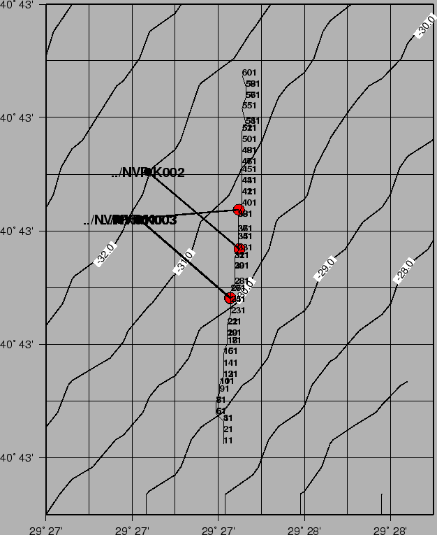
Sea bottom sampling was performed in the Area D and in the Area A.
One gravity core was taken in the deepest portion of Cinarcik Basin.
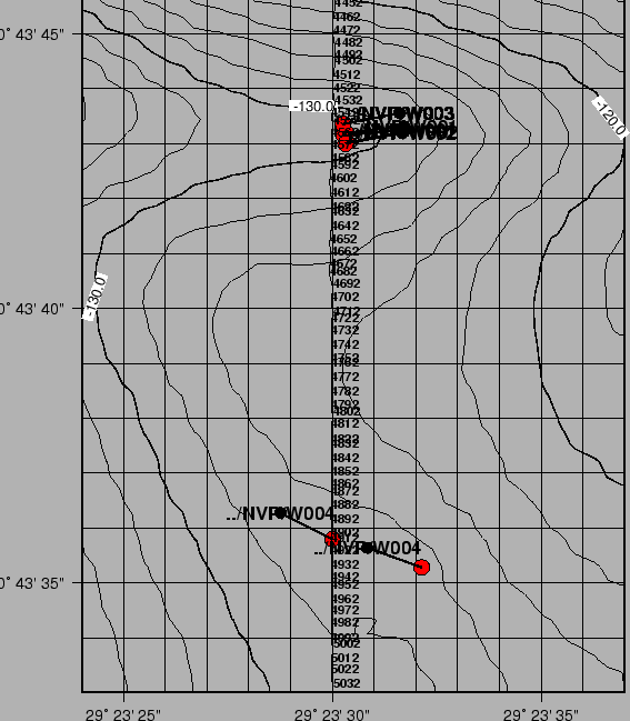
Area D was chosen because of the presence of presumably active faults. Two transects
of respectively three gravity cores and four water/sediment cores were collected across two faults.
The continental shelf Area A was sampled to investigate stratigraphic/structural
features rising few meters above the surrounding, according to a possible interpretation as
relict sand dunes or gas escaping mounds or biohermal reefs.
Finally, the core on Cinarcik basin will provide a more complete stratigraphic record of the area.
Some additional grab samples were taken troughout.
Fig.23 and 24 show some samples. The coordinates are reported in Tab.4.
Figure 23:
Core samples.Gravity corer
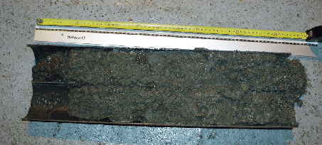 |
Figure 24:
Core samples.Water/sediment SW104.
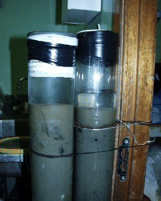 |
Table 4:
Positioning data of the Sea Bottom Samples
|
DATE |
TIME |
NAME |
TYPE |
LAT |
LON |
DEPTH |
RECOVERY(CM) |
|
01-11-2000 |
13:45:30 |
K001 |
Gravity |
40:43.0696 |
29:27.9881 |
30.2 |
161 |
|
01-11-2000 |
16:46:09 |
K002 |
Gravity |
40:43.0635 |
29:27.9877 |
29.3 |
152 |
|
01-11-2000 |
17:49:32 |
K003 |
Gravity |
40:43.0563 |
29:27.9859 |
33.7 |
148 |
|
01-11-2000 |
18:51:50 |
K004 |
Gravity |
40:43.3101 |
29:28.2280 |
25.3 |
51 |
|
01-11-2000 |
19:44:23 |
G001 |
grab |
40:43.7846 |
29:27.4661 |
57.6 |
|
|
01-11-2000 |
20:41:43 |
G002 |
grab |
40:43.8155 |
29:27.4722 |
57.3 |
|
|
02-11-2000 |
01:16:28 |
W001 |
SW104 |
40:43.7203 |
29:23.5056 |
131.6 |
116 |
|
02-11-2000 |
02:26:32 |
W002 |
SW104 |
40:43.7172 |
29:23.5058 |
130.8 |
115 |
|
02-11-2000 |
04:21:24 |
W003 |
SW104 |
40:43.7229 |
29:23.5039 |
132.5 |
120 |
|
02-11-2000 |
16:01:44 |
W004 |
SW104 |
40:43.5872 |
29:23.5329 |
126.3 |
119 |
|
02-11-2000 |
19:51:43 |
K005 |
Gravity |
40:45.0011 |
29:06.9995 |
1275.0 |
223 |
|
03-11-2000 |
14:48:00 |
G003 |
grab |
40:54.7310 |
28:40.1882 |
81.5 |
|
|
03-11-2000 |
15:57:38 |
K006 |
Gravity |
40:54.7332 |
28:40.1903 |
81.0 |
58 |
|
03-11-2000 |
16:38:43 |
K007 |
Gravity |
40:54.7325 |
28:40.1897 |
81.0 |
53 |
|
03-11-2000 |
17:30:44 |
K008 |
Gravity |
40:54.7141 |
28:40.1859 |
80.0 |
96 |
|
|
|
|
|
|
|
|
|
figure
Figure 25:
IZMIT
 |
figure
Figure 26:
IZMIT
 |
figure
Figure 27:
IZMIT
 |
figure
Figure 28:
IZMIT
 |
figure
Figure 29:
IZMIT
 |
Next: ON-GOING DATA PROCESSING AND
Up: RESULTS AND DISCUSSION
Previous: SBP - SSS
2001-05-11