 |
Modeling and planning have been performed in order to obtain best results in order to carry out wide angle seismic refraction survey of the Stromboli island [Di Fiore et al. (2006)]
We therefore planned to:
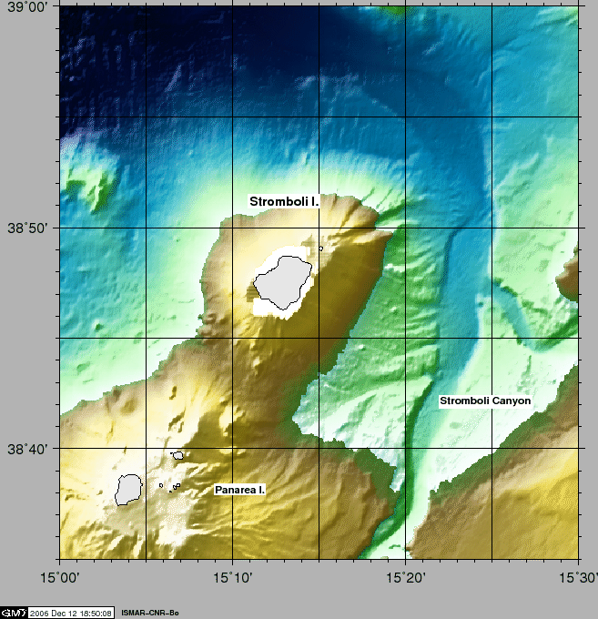
Best station coverage was presumably on N-S and ENE-WSW runlines (P1 and P2 of Fig. 3).
To model seismic wave behaviour and possible results, and bearing on mind that penetrating energy is limited by (a) sound channel availability and (b) strong gradients on the flanks of volcano producing post-critical incidences limiting transmission, we worked on obtaining data about wave propagation
See in Appendix 7.2 the mathematical details.
figure
 |
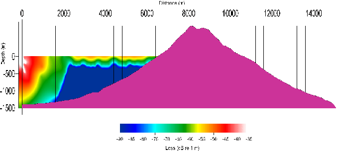
Figure 4 is a 2-D section along the line P2 of Figure 3 showing losses from energy measured @ 1m from source, where distribution of density, temperature and Sound Velocity in the water column were taken from [Waite (2002)] and with frequency band 10-200 Hz. Figure 4 evidences a 'shadow' zone generated by speed of sound variations at depths of 200 m, determining a sub-sampling of sea bottom up to full obscurement of the area at distances greater than 2000 m. Furthermore, at distances of 2000 m attenuation is around 50 dB, therefore the source effect is almost vanished. The analysys suggested to shot at an optimal distance of 1000 m from shore, avoiding whenever possible the effusive phases to increase S/N ratios, and make multiple shots on stations to allow stacking of signals.
figure
figure
 |