

Next: SCIENTIFIC AND TECHNICAL PARTIES
Up: STR06_REP
Previous: MODELING AND PLANNING
Contents
CRUISE SUMMARY
SHIP: R/V Urania
START: 2006-11-27 PORT: Naples
END: 2006-12-06 PORT: Naples
SEA/OCEAN: Tyrrhenian Sea, Mediterranean Sea
LIMITS: NORTH 39:45 SOUTH: 38:55 WEST: 14:05 EAST: 14:45
OBJECTIVE: INTEGRATED STUDY OF THE STROMBOLI SMT.
COORDINATING BODIES: IAMC-CNR
CHIEF OF EXPEDITION: Dr. Gemma Aiello
CONTACT: Gemma.Aiello@iamc.cnr.it
DISCIPLINES: WIDE ANGLE SEISMIC REFRACTION, MORPHOBATHYMETRY
WORK DONE: 1890 SEISMIC SHOTS, 290 KM SURVEY MULTIBEAM, xxxx KM SBP
2 CTD CAST
LOCALIZATION:
figure
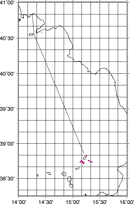
Figure 5:
Whole ship track during Cruise STR06, including transits. The red circles are seismic shots.
 |
figure
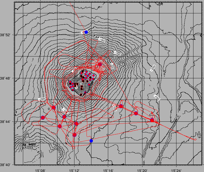
Figure 6:
Ship track during Cruise STR06 in the study area.
The red lines are seismic shots. The blue squares are the OBS positions. The two blue circles are the CTD casts.
Bathymetry from this cruise data and [Marani, Gamberi and Bonatti(2004)],[Bortoluzzi et al.(1999)] deeper than 2200 m. Topography from SRTM.
 |
2007-06-18

