During some 100 days of work at sea we have run aproximately 36000 Km of multibeam and geophysics lines in the Tyrrhenian and Ionian Sea, thus obtaining almost the full bathymetric coverage of the Thyrrhenian Sea from an average depth of 500 m down to the bathyal plain. The data were processed and DTMs were produced with a resolution of 100 m and even better in some areas. From these DTMs, maps at scales ranging from 1:50000 to 1:1000000 can easily be produced, by using the single grids or joining them to make larger ones, at the same resolution or lower.
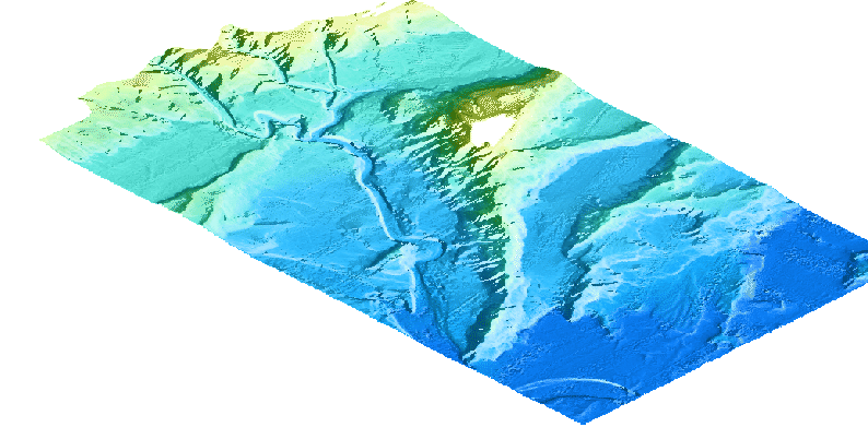
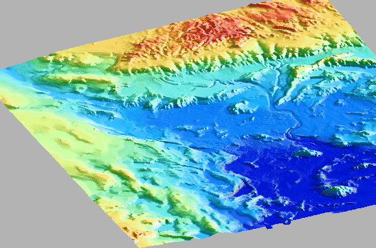
Figures 27 and ![]() present 3-d shaded
reliefs maps at different scales and resolutions.
present 3-d shaded
reliefs maps at different scales and resolutions.
At this stage of data processing, the swath bathymetry data may be used at 1:100000 and smaller scales. Spots at larger scales may also be possible. We still have some work to perform on some noisy data in the deeper flat portions of the basin. In addition, much work have to be done on the integration of bathymetry and reflectivity data.
Magnetic and gravity data were recorded along the multibeam navigation lines, with a spatial resolution which varied with the line spacings. We expect to be able to produce grids at the resolution of 500 m and even better. Unfortunately, we were not able to collect gravity data during the first leg of cruise TIR99. The processing of the data is ongoing.
Seismic data were also collected along the multibeam lines, giving the possibility to better define the sedimentary cover and structures.
The data collected can be considered of good quality, and have a large potential for further processing and integration with existing or future data.
figure
 |
 |