The present project is based on many previous research cruises carried out using Odin Finder and Urania research vessels within the framework of an Italy/Turkey collaborative programme.
The key areas have been identified through the interpretation of the previously collected geophysical and geological data along the NAF strands and cruise work was designed in order to map active structures and features likely useful to understand fault kinematics.
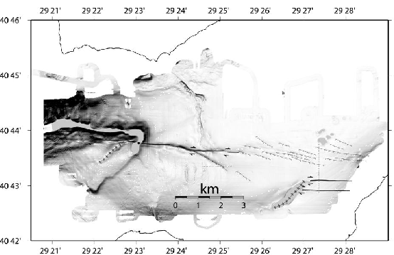
During cruise MARM2009 the INGV's SN-4 seafloor observatory was deployed in the main strand of the NAF at the entrance of the Izmit Gulf, between Darica and Yalova.
For details about these cruises see [Bortoluzzi et al., 2001b], [Bortoluzzi et al., 2001a], [Bortoluzzi et al., 2005] and [Gasperini et al., 2009].
figure