|
figure
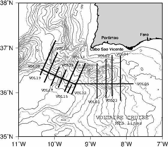
During the cruise we performed quality control on the shooting interval for MCS which is the critical parameter defining the geometry. The software installed on board allowed to shoot at the constant spacing of 50 m. To perform this the time interval was varied to account for differences in the ship velocity. Using the navigation files the program nav01.f extracts the relevant information for the shots and outputs a label file used for gmt plotting. The same navigation file is explored by vnafdkm.f program to output a navdiff.dat file where we have in different columns the time interval between shots, the distance interval and the average ship velocity between shots estimated from the previous 2 values.
As the shooting time is recorded only to the second, a small fluctuation is observed in the time interval (and consequently a corresponding variation in velocity) that is not real, but due only to rounding. As it can be seen by the example shown in Fig. 25, Fig. 26 and Fig. 27 (prepared by the navdiff.csh script) we obtained a very stable shooting interval and the differences in velocity were well compensated by symmetrical differences in the shot time interval. Compared to other recent academic MCS surveys we must stress that the VOLTAIRE shooting system performed extremely well.
figure
figure
figure
figure