 |
In this section we will present the data acquired and some very preliminary processing, with the aim of showing their quality and of addressing their potential and importance in the whole processing sequence. As explained in Chapter 3, during the SBP, MULTIBEAM and MCS runs, other than in transit, we acquired (a) bathymetric data with a DESO 25 single beam echosunder @1500m/sec, (b) magnetics and (c) conductivity/temperature at 3.5m water depth.
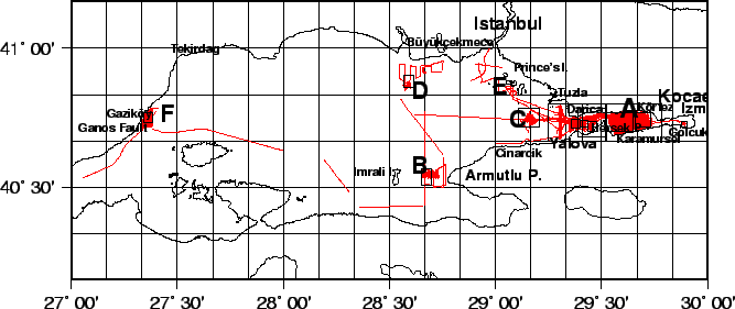
Fig.32 shows the pattern of the multibeam and SBP lines that were run during the 19 days of operation in the area, up to a total mileage of roughly 2250 KM. Figures 61 to 60 in Appendix 4 give details of the investigated areas, including the coring, CTD and ROV stations.