 |
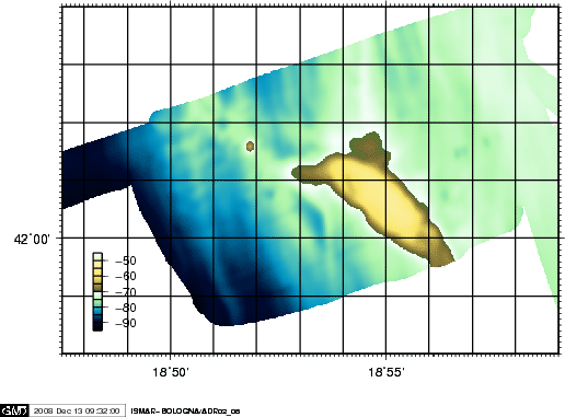
The upper slope is covered by a thick sedimentary fine grained sediments, with evident instabilities and mass sliding processes. A shallower semicircular, compressional structure, bordered by sediment drift depositional morphologies dominates the region. Paleoshorelines and dune fields are also present, particularly at -120 and -80-70 m depth. The area in front of Bar, mapped during the ADR0208 Urania cruise, shows the presence of an elliptical morphological high, with an intriguing, truncaded cone feature on the west, and bordered to the SW by dune and sand-bar morphologies (Fig.7). The truncated cone, which elevates 20-30m from the surrounding sea floor, was mapped and sampled in detail (Fig.8).
figure
figure