The vessel is set-up for data acquisition and navigation with RESON PDS-2000 software.
Two workstations were used for multibeam data acquisition and QC, interfacing by a multiserial and Ethernet link a RESON 8150 81P processor, an IXEA Octans MRU and gyrocompass, and a Trimble DGPS receiver. Other computers logged magnetics, SBP, meteorological station, conductivity/temperature sensors at the keel, dredging cable tension and the DGPS receiver.
The datum WGS84 and the Direct Mercator projection on 48S were chosen for navigation and display purposes. Timing was set to UTC (some problems occured with the PDS2000 WS set to accomodate the daylight saving time automatically).
A Marine Magnetics SeaSpy Magnetometer tow fish was towed 210m astern, on the port side.
For Multichannel survey a GI-GUN tuned array seismic source was towed 15 m astern, and the first active section of the 48 Ch. seismic streamer was towed 106.5m from the array.
A full-speed, air-gun single channel reflection seismic system was towed on the starboard side.
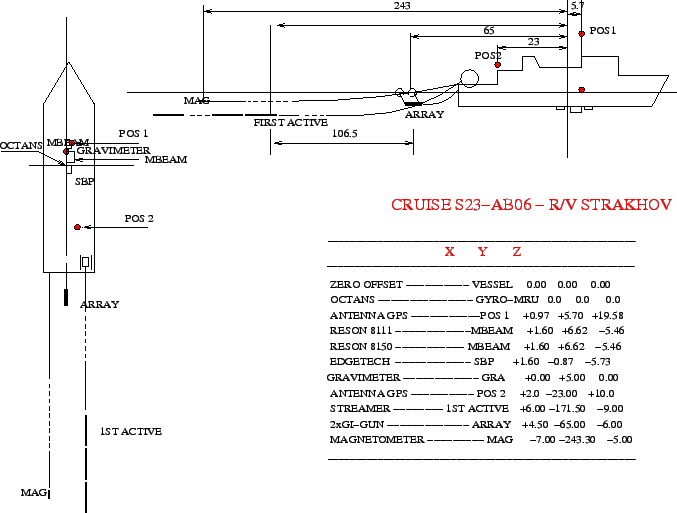
The instrumental offsets are presented in Fig. 6 and in Tab. 3.
figure