


Next: SCIENTIFIC AND TECHNICAL PARTIES
Up: MARM05_REP
Previous: PLANNING AND STRATEGY
Contents
CRUISE SUMMARY
SHIP: R/V Urania
START: 2005-09-08 PORT: Rhodes
END: 2005-10-05 PORT: Bari
SEA/OCEAN: Sea of Marmara, Mediterranean Sea
LIMITS: NORTH 40:00.0 SOUTH: 41:15.0 WEST: 25:30.0 EAST: 30:00
OBJECTIVE: Active Faults and historical earthquakes in the Marmara Sea
COORDINATING BODIES: ISMAR-Bologna BOLOGNA (ITALY)
CHIEF OF EXPEDITION: Luca Gasperini (ISMAR-CNR)
CONTACT: Luca.Gasperini@ismar.cnr.it
DISCIPLINES: SWATH BATHYMETRY, SBP, MCS, SEABED SAMPLING
WORK DONE: 1300 KM SURVEY + 200 KM TRANSIT MULTIBEAM,
4900 KM SBP, 274 KM MCS
7 GRABS, 23 GRAVITY CORES (1 EMPTY), 5 SW CORES
25 CTD CASTS, 18 XBT
LOCALIZATION:
figure
Figure 5:
General ship track during Cruise MARM05, including transits
from Rhodes and to Bari. The red circles are sediment samples
(cores,grabs), the blue squares are CTD casts and XBT launches.
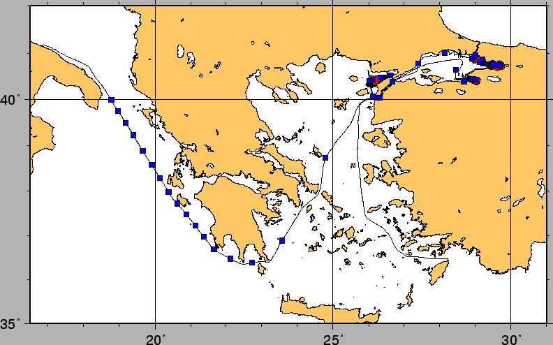 |
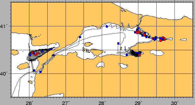
Figure 6:
Ship track during Cruise MARM05 in the Marmara Sea and Gulf of
Saros. The red circles are sediment samples
(cores,grabs), the blue squares are CTD casts and XBT launches.
 |
figure
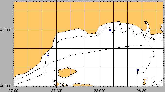
Figure 7:
Ship track during Cruise MARM05 in the Gulf of Saros. The red circles are sediment samples
(cores,grabs), the blue squares are CTD casts and XBT launches.
 |
figure
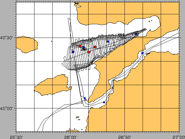
Figure 8:
Ship track during Cruise MARM05 in western and central Marmara Sea.
The red circles are sediment samples
(cores,grabs), the blue squares are CTD casts and XBT launches.
 |
figure
Figure 9:
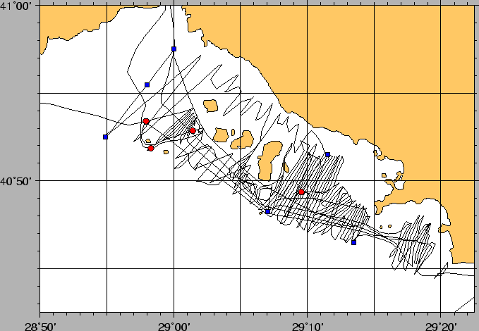
Ship track during Cruise MARM05 in the Princes Islands region. The red circles are sediment samples
(cores,grabs), the blue squares are CTD casts and XBT launches.
 |
figure
Figure 10:
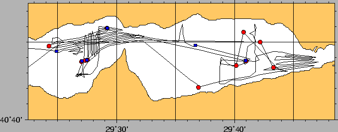
Ship track during Cruise MARM05 in the Izmit gulf. The red circles are sediment samples
(cores,grabs), the blue squares are CTD casts and XBT launches.
 |
figure
Figure 11:
Ship track during Cruise MARM05 in the Gulf of Gemlik. The red circles are sediment samples
(cores,grabs), the blue squares are CTD casts and XBT launches.
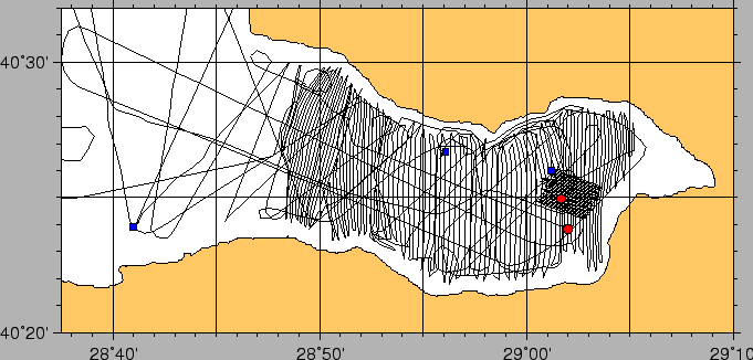 |
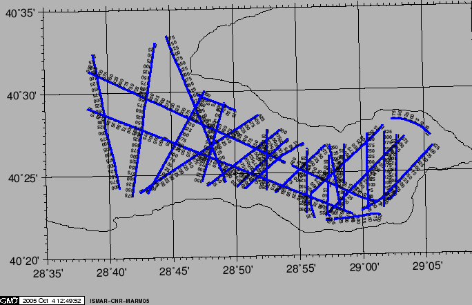
Figure 12:
MCS Ship track in the Gemlik Gulf during Cruise MARM05.
 |
Next: SCIENTIFIC AND TECHNICAL PARTIES
Up: MARM05_REP
Previous: PLANNING AND STRATEGY
Contents
2005-12-08