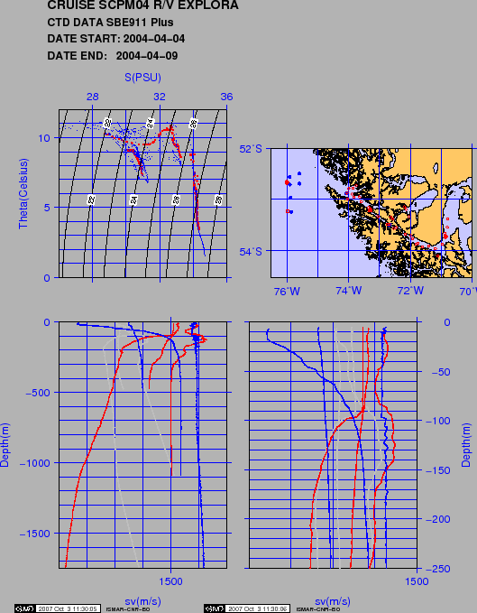
Figure 16 shows the SV, temperature and salinity profiles, the THETA-S diagram and location of the CTD casts. The physical water properties in the surveyed area were studied by ![]() -S diagram obtained with the CTD data collected during the cruise combined with samples in the same areas extracted from World Ocean Data 2001 [Conkright et al.(2002)].
-S diagram obtained with the CTD data collected during the cruise combined with samples in the same areas extracted from World Ocean Data 2001 [Conkright et al.(2002)].
CTD1 in the Paso Ancho shows the lower salinity values and mixed water column. CTD2 cast in the western passage presents a well developped halocline, due to higher run-off and fjord and channel morphology, other than a higher salinity water body from the Pacific. CTD4 in the Ocean is typical of West-drift current driven Chilean SAMW, with temperature range from ![]() 9°C to
9°C to ![]() 2.4°C and lower salinity AAIW water above 1000m water depth.
2.4°C and lower salinity AAIW water above 1000m water depth.
The ThermoSalinometer data in the Ocean (Fig.17) show a large variation in the surface temperature distribution, with higher values toward the Strait and a well depicted frontal structure..
figure
 |
figure