next up previous contents
Next: T-FLAP Up: OCEANOGRAPHICAL PROFILING Previous: SATELLITE IMAGERY   Contents

CTD

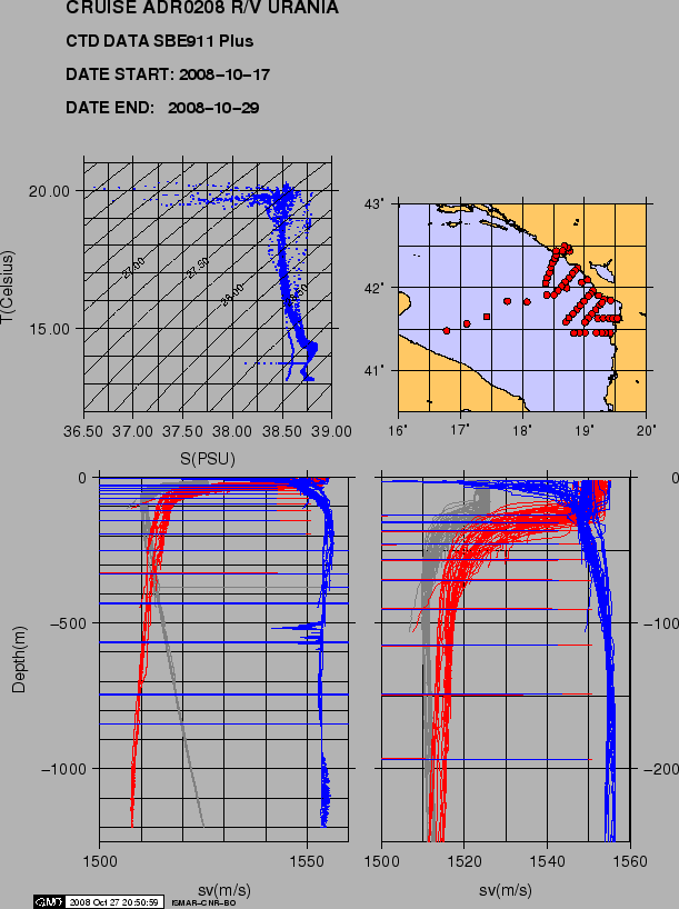
Figure 8 shows the CTD data of all the samples collected.

figure

Figure 8: Cruise ADR0208. CTD data.
\begin{figure}\centerline{\epsfig{file=IMG/ADR0208_CTD.eps,width=13.5cm}}
\end{figure}

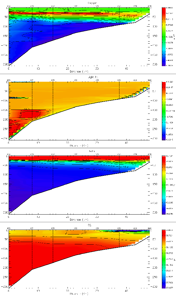
For the sake of showing data quality we present some examples of the oceanographical data collected along transect 2 of ADRICOSM project (stations 63 to 67, Fig.9), i.e. salinity, temperature, O$_2$,

figure

Figure 9: Cruise ADR0208. CTD data, transect ADRICOSM 2. From top to bottom: O$_2$, transmissometer, temperature, salinity.
\begin{figure}\epsfig{file=IMG/adr02_63-67_adricosm2_o2.eps,width=13.5cm}
\epsf...
...3.5cm}
\epsfig{file=IMG/adr02_63-67_adricosm2_s.eps,width=13.5cm}\end{figure}


root 2009-01-11