next up previous contents
Next: SCIENTIFIC AND TECHNICAL PARTIES Up: TIR10_REP Previous: OCEANOGRAPHIC SETTING   Contents


CRUISE SUMMARY

SHIP: R/V Urania  Flag: Italy [IT] Call Sign: IQSU IMO: 9013220, MMSI: 247498000 START: 2010-10-19 PORT: Napoli
END: 2010-10-28 PORT: Napoli
SEA/OCEAN: Tyrrhenian Sea, Mediterranean Sea
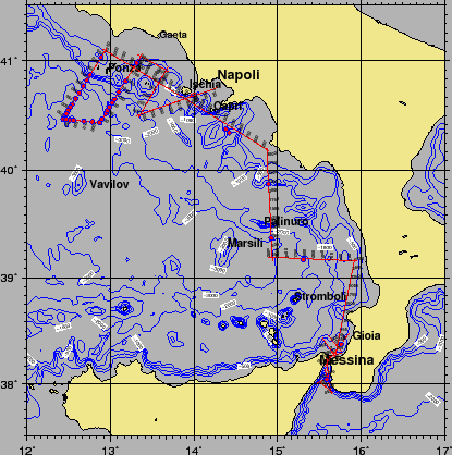
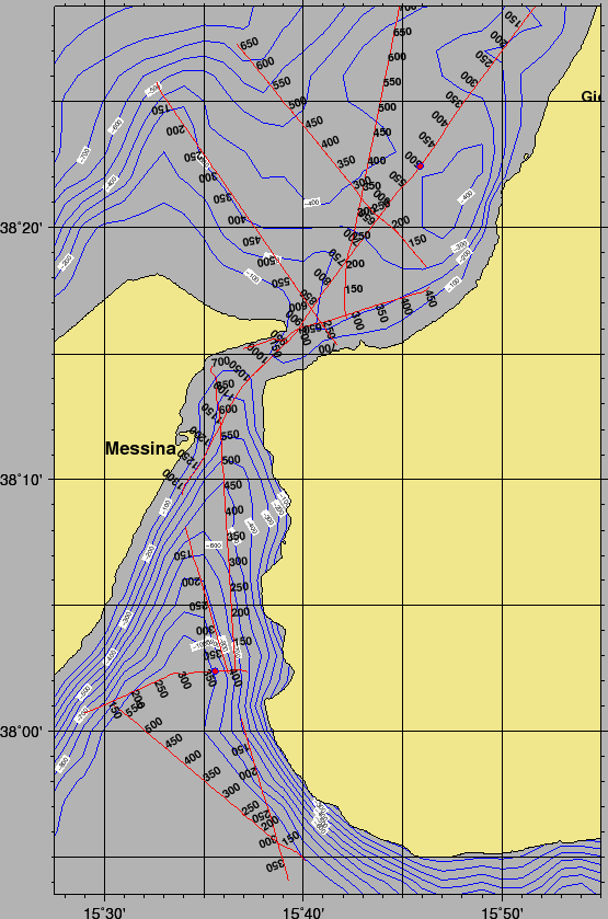
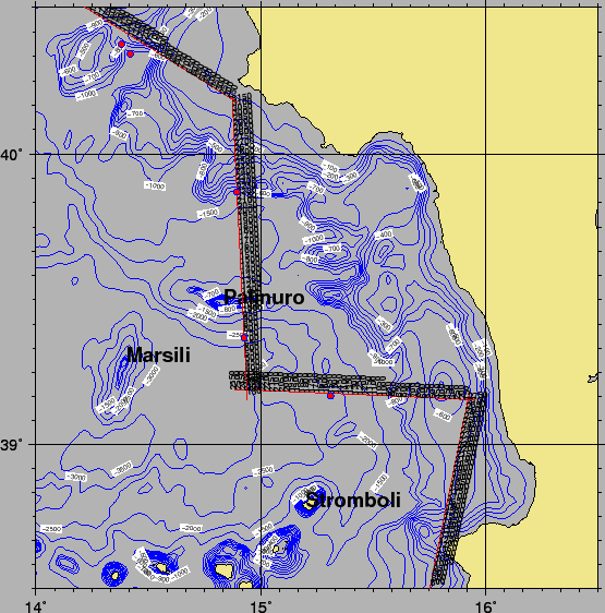
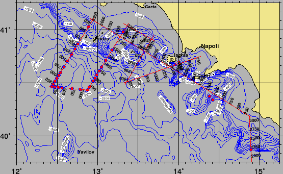
LIMITS: NORTH 41:10.0 SOUTH: 37:50.0 WEST: 12:20.0 EAST: 16:00
OBJECTIVE: Multichannel line acquisition in the Tyrrhennian Sea
COORDINATING BODIES: IGAG ROME ISMAR BOLOGNA (ITALY)
CHIEF OF EXPEDITION: Marco Ligi (ISMAR-CNR)
CONTACT: Marco.Ligi@ismar.cnr.it
DISCIPLINES: MARINE GEOLOGY, MARINE GEOPHYSICS, SEISMIC OCEANOGRAPHY, PHYSICAL OCEANOGRAPHY
WORK DONE: 1006 KM MULTICHANNEL REFLECTION SEISMIC, $\sim$100 KM$^2$ MULTIBEAM, $\sim$1000 KM SBP, 1 CTD CASTS, 40 XBT Drops,

LOCALIZATION:

Figure 1: Ship tracks during Cruise TIR10. Red and blue circles are CTD and XBT drops, respectively
\begin{figure}\centerline{\epsfig{
file=IMG/TIR10_NAV_CRUISE.eps,width=0.75\linewidth}}
\end{figure}


figure

Figure 2: Ship tracks during cruise TIR10 , Strait of Messina Area. Red and blue circles are CTD and XBT drops, respectively.
\begin{figure}\epsfig{file=IMG/TIR10_NAV_BOX2.eps,width=\linewidth}\end{figure}


figure
Figure 3: Ship tracks during cruise TIR10 , SE Tyrrhenian Sea. Red and blue circles are CTD and XBT drops, respectively.
\begin{figure}\epsfig{file=IMG/TIR10_NAV_BOX3.eps,width=\linewidth}\end{figure}


figure
Figure 4: Ship tracks during cruise TIR10 , Pontine I. Area. Red and blue circles are CTD and XBT drops, respectively.
\begin{figure}\epsfig{file=IMG/TIR10_NAV_BOX1.eps,width=\linewidth}\end{figure}


next up previous contents
Next: SCIENTIFIC AND TECHNICAL PARTIES Up: TIR10_REP Previous: OCEANOGRAPHIC SETTING   Contents
2010-10-31