

Next: CTD
Up: INITIAL RESULTS
Previous: LAND
Contents
A surface of approximately 290 km was investigated during the cruise.
Mapping on board was performed by using the PDS-2000 production DTM, converted to ASCII,
filtered by ISMAR's routine
 filter_bat,gridded by the nearneighbor GMT routine.
The obtained grids were used for navigation, planning, geomorphological and structural analysis.
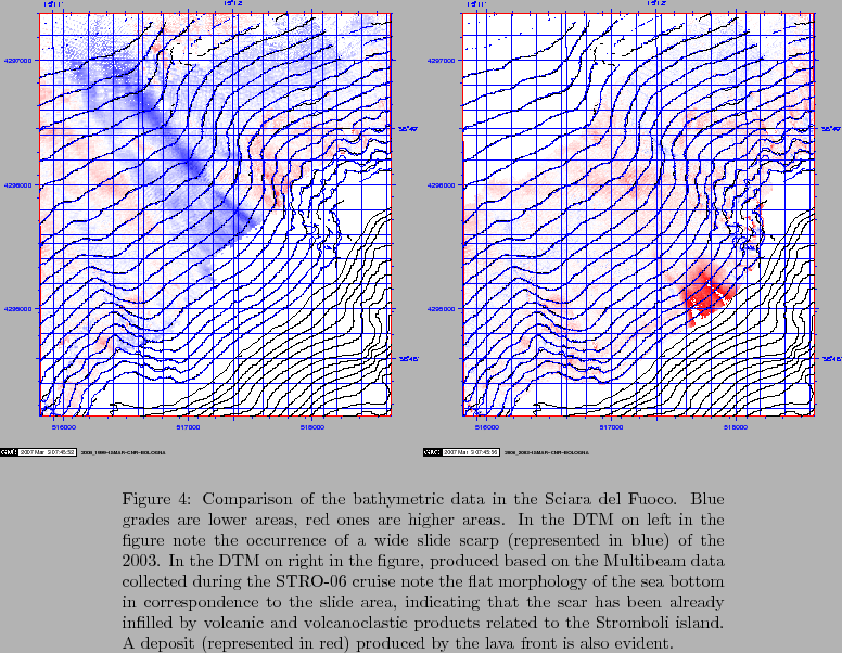
The whole sumberged portion of the volcano was mapped. Particular attention was put on the 'Sciara del fuoco' area, trying to collect as much data as possible on the area of the submarine slide of 2002-12-30. (Figure 27 shows
the variations occured in the area by comparing the 1999-03, 2003-01 and 2006-11 the DTM data, showing that the scarp built by the slide was refilled down to 250m water depth by the continuous effusive episodes up to mid 2003.).
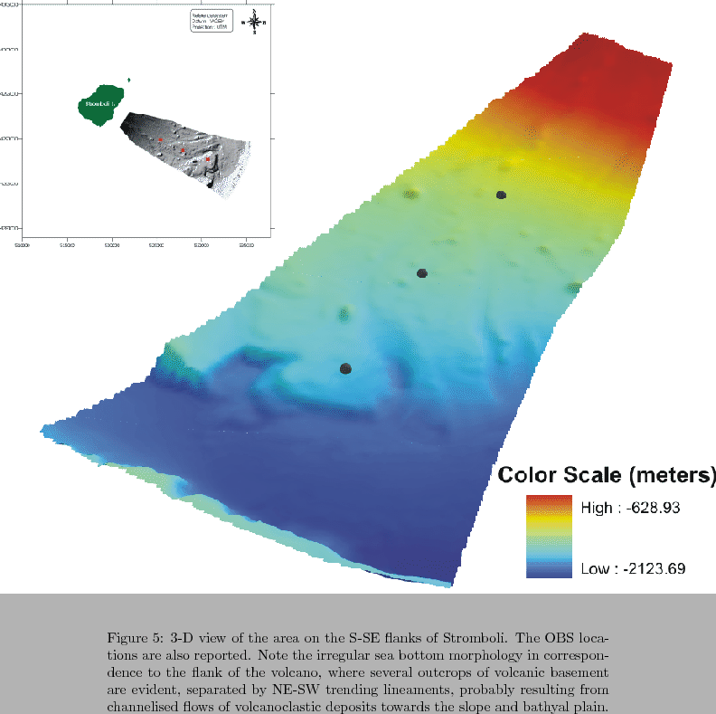
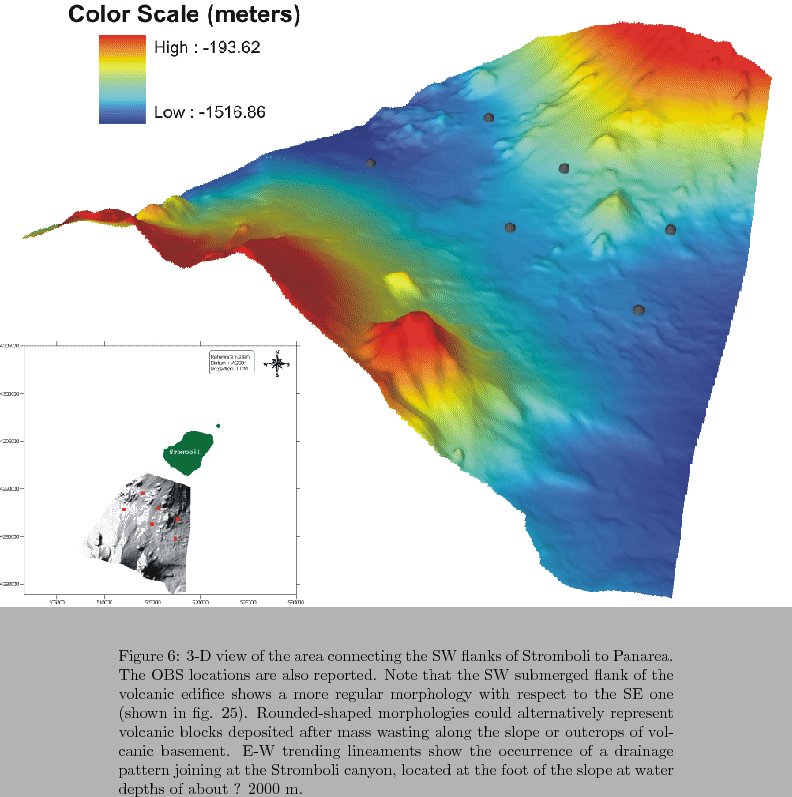
Figures 28 and 29 show examples of
the acquired bathymetric data from the filtered 20 m resolution PDS-2000 production DTM.
figure
figure
figure
2007-06-18


