 |
Several square KM of data were collected and will require several months of work for processing.
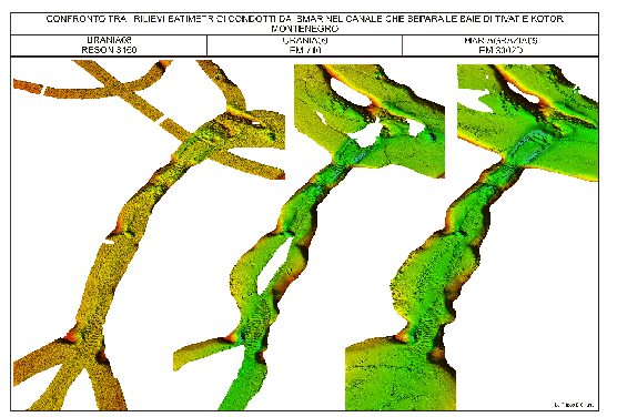
Tha bay of Kotor was almost fully mapped. The Verige Strait, connecting the Central Bay of Tivat to the Bay of Kotor, shows very steep flanks that continue into the embayment, being stopped by a steep, narrow ridge, parallel to the S coastline, which elevates above surface with the man-made Island of Gospa od Skrpjela We present (Fig.12) multibeam images of the strait from the two Urania cruises performed in October 2008, April 2009 and this one, aiming at the comparison between three different multibeam systems (Reson 8160, Kongsberg EM710 and Em3002D).
figure
 |