

Next: SCIENTIFIC AND TECHNICAL PARTIES
Up: MNG0209_REP
Previous: Oceanographical Setting
Contents
CRUISE SUMMARY
SHIP: R/V Maria Grazia
START: 2009-07-11 PORT: Messina
END: 2009-07-25 PORT: Monopoli
SEA/OCEAN: Southern Adriatic Sea, Mediterranean Sea
LIMITS: NORTH 42:40 SOUTH: 41:00 WEST: 18:00 EAST: 19:30
OBJECTIVE: MORPHOBATHYMETRIC AND GEOLOGICAL SURVEY
COORDINATING BODIES: ISMAR-CNR
CHIEF OF EXPEDITION: Mr. Giovanni Bortoluzzi
CONTACT: G.Bortoluzzi@ismar.cnr.it
DISCIPLINES: PHYSICAL AND BIO-GEOCHEMICAL OCEANOGRAPHY, SWATH BATHYMETRY, GEOPHYSICS
WORK DONE: , 1400 KM SBP, 900 KM magnetometric, 2000 KM gravimetric data, about 200 KM Of SWATH MULTIBEAM, 36 CTD STATIONS, 25 BOX-CORERS (19x19x25 cm), 13 CORES (1 6.0m, 11 3.6m pipe).
LOCALIZATION:
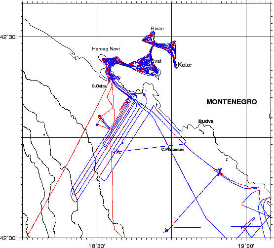
figure
Figure 3:
Whole ship track during Cruise MNG02_09 . Blue circles are CTD stations. Red squares are bottom Stations.
 |
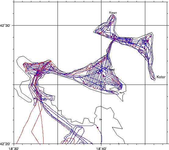
figure
Figure 4:
Whole ship track during Cruise MNG02_09 , Northern area. Blue circles are CTD stations. Red squares are bottom Stations.
 |
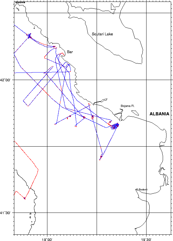
figure
Figure 5:
Whole ship track during Cruise MNG02_09 , southern area. Blue circles are CTD stations. Red squares are bottom Stations.
 |
Figure 6:
Whole ship track during Cruise MNG02_09 , southern area. Blue circles are CTD stations. Red squares are bottom Stations.
 |


Next: SCIENTIFIC AND TECHNICAL PARTIES
Up: MNG0209_REP
Previous: Oceanographical Setting
Contents
2009-09-02


