


Next: SCIENTIFIC AND TECHNICAL PARTIES
Up: ADRIASEIS09_REP
Previous: Oceanographical Setting
Contents
CRUISE SUMMARY
SHIP: R/V Urania, CNR
START: 2009-03-03 PORT: Bari
END: 2009-03-16 PORT: Bari
SEA/OCEAN: Southern Adriatic Sea, Mediterranean Sea
LIMITS: NORTH 42:40 SOUTH: 41:10 WEST: 15:20 EAST: 17:40
OBJECTIVE: GEOPHYSICAL OCEANOGRAPHY
COORDINATING BODIES: ISMAR-CNR
CHIEF OF EXPEDITION: Dr. Sandro Carniel
CONTACT: S.Carniel@ismar.cnr.it
DISCIPLINES: OCEANOGRAPHY, GEOPHYSICS, SWATH BATHYMETRY
WORK DONE: 38 CTD CASTS, 240 XBT DROPS, 583KM MULTICHANNEL SEISMICS, 1180 KM SBP, about 500KM OF SWATH BATHYMETRY.
LOCALIZATION:
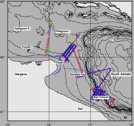
figure
Figure 2:
Whole ship track during Cruise ADRIASEIS09 in the Southern Adriatic Sea. Red squares are CTD, blue diamonds are XBT and green circles are Turbulence stations.
 |
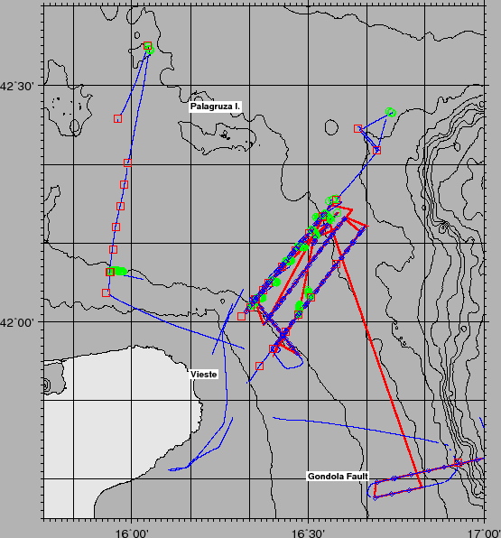
figure
Figure 3:
Whole ship track during Cruise ADRIASEIS09 in the Southern Adriatic Sea. Red squares are CTD, blue diamonds are XBT and green circles are Turbulence stations.
 |
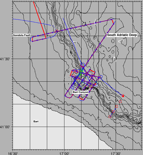
figure
Figure 4:
Whole ship track during Cruise ADRIASEIS09 in the Southern Adriatic Sea. Red squares are CTD, blue diamonds are XBT and green circles are Turbulence stations. Filled red square is the current meter mooring deployed for the Hermione Project.
 |
Next: SCIENTIFIC AND TECHNICAL PARTIES
Up: ADRIASEIS09_REP
Previous: Oceanographical Setting
Contents
2009-12-16